Aerial Imagery & Thermal Drone Services


At Black Label Imagery, our cutting-edge drone services are revolutionizing the way we capture stunning visuals from the sky. Equipped with the latest technology and operated by our skilled licensed pilot, our drones offer limitless possibilities for aerial photography, videography, and search and rescue missions. From capturing breathtaking landscapes, providing unique angles for real estate listings, to thermal deer recovery. Our drone services add a new dimension to any project. The number of applications is absolutely endless and we are ready to help you meet all of your goals from the sky!
We currently offer:
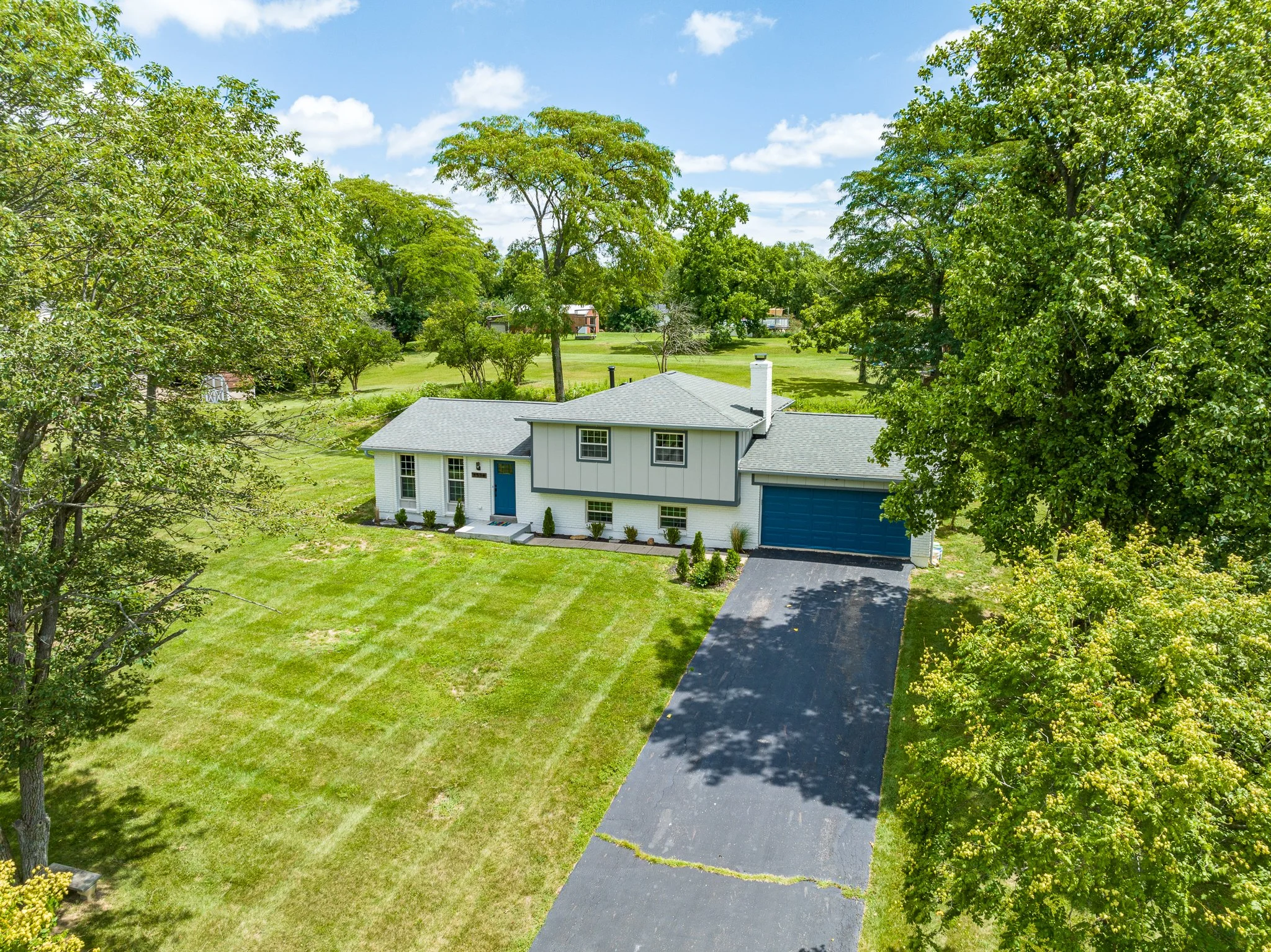
Real Estate Photography & Videography (see RE tab for details)
Advertisement & Event Photography & Videography
Natural Disaster & Storm Damage Assessment
Thermal Deer Recovery
Missing Livestock Searches & Headcount
What do we fly?
The Black Label Imagery fleet currently consists of the DJI Mavic 3, and the DJI Matrice 30T.

DJI Mavic 3
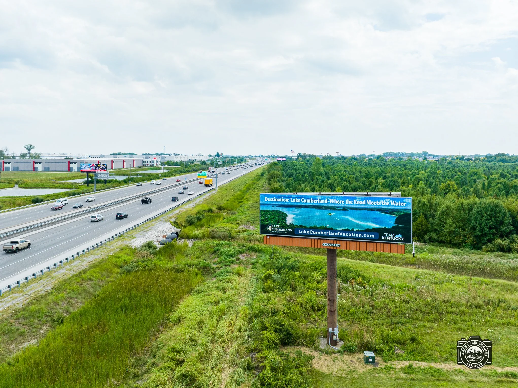
Equipped with a 20 megapixel 4/3 cmos sensor Hasselblad camera that produces stunning colors and detail, we use the Mavic for all things photography & videography. We’ve even had photos featured on billboards and in vacation guides!

DJI Matrice 30T
The 30T is equipped with a range of payloads that make recovery missions precise & efficient. Highlighted by the thermal & zoom camera/ JZ T60 spotlight combination that aid in identifying heat signatures and targets of interest with ease. The Matrice has the ability to fly in harsh weather conditions making it the perfect tool for all search and rescue missions. Day or night. Rain or shine.

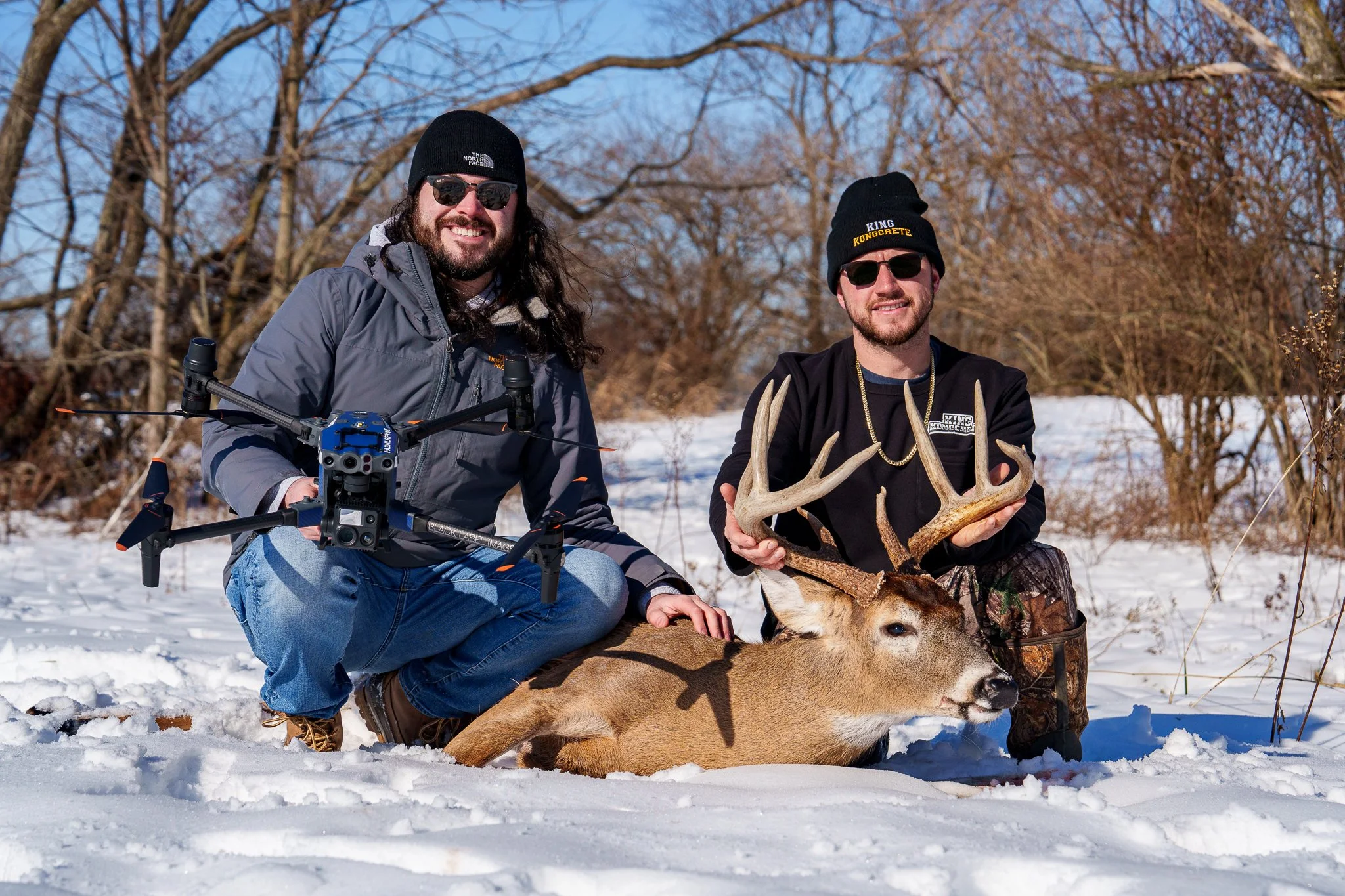
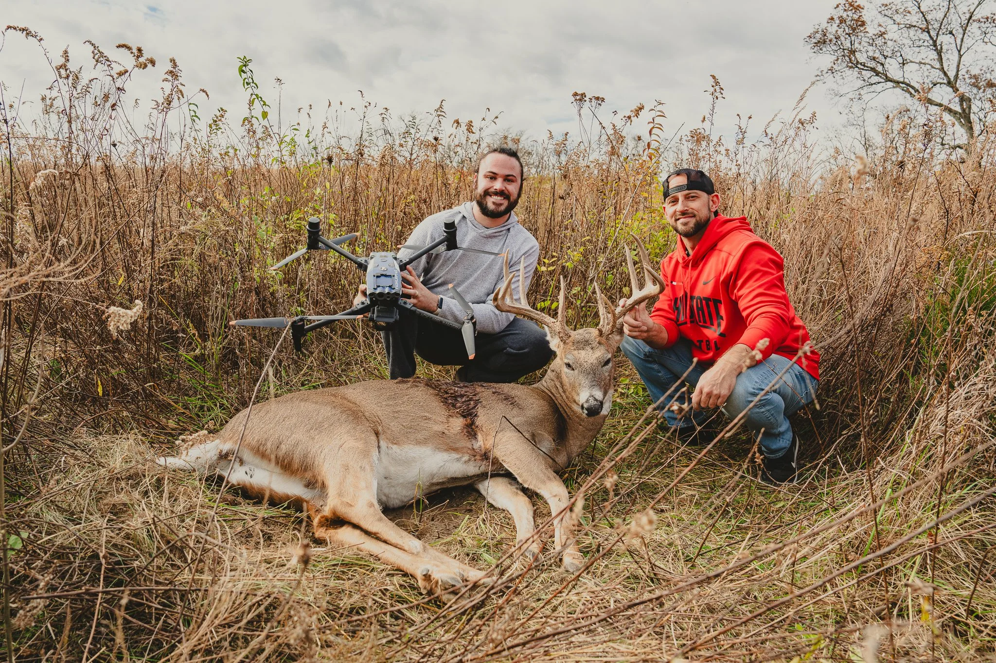
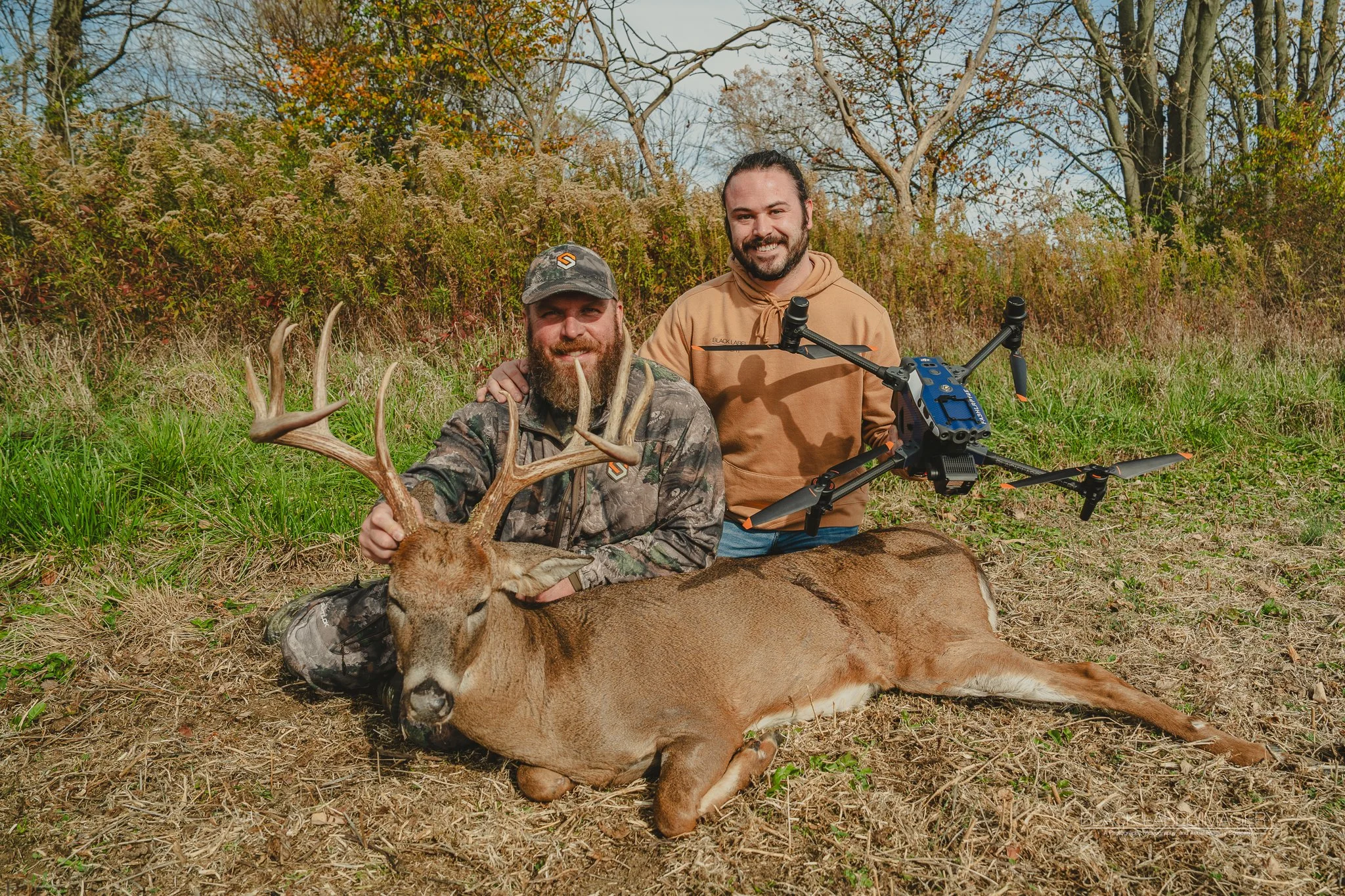
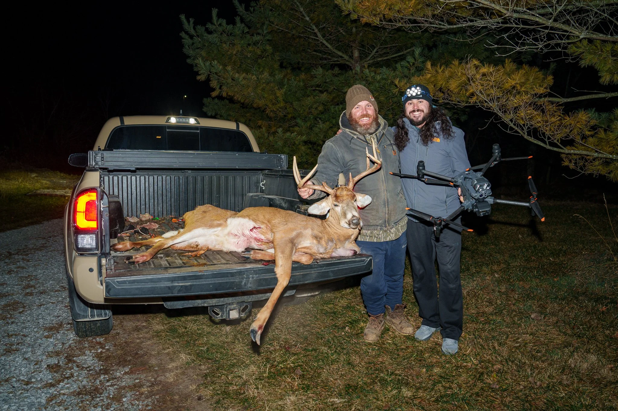
Photo from a November evening deer recovery in Casstown, Ohio.
Thermal Deer Recovery
Dayton, Ohio’s #1 Drone Deer Recovery Service
We take pride in being the first established thermal deer recovery business in the Dayton Region. By using a drone for deer recovery offers hunters a plethora of benefits that could greatly enhance their hunting experience. Our drone utilizes thermal imaging to detect heat signatures, enabling pilots to locate injured or downed deer with remarkable efficiency. Unlike traditional recovery methods, thermal drones can effectively scan large areas and dense foliage, making it easier to pinpoint the exact location of the downed deer. This not only saves precious time but also increases the chances of successful recovery. With our ability to cover vast terrains in almost any weather conditions, we can always get the job done. We are outfitted to the point that we are able to stay and fly until the deer is located, day or night. It is our goal to make sure you have your hard earned game in your hands, and meat in your freezer!
We have tracked down deer that were shot up to 48 hours before we started looking, but we highly recommend reaching out to us as soon as you lose a blood trail or confidence in tracking. This helps prevent bumping the deer if they are wounded and reduces the chance of losing them for good.
We are currently servicing the following counties in Ohio:
Miami, Montgomery, Clark, Darke, Champaign, Warren, Greene, Butler, Preble, and Shelby County.

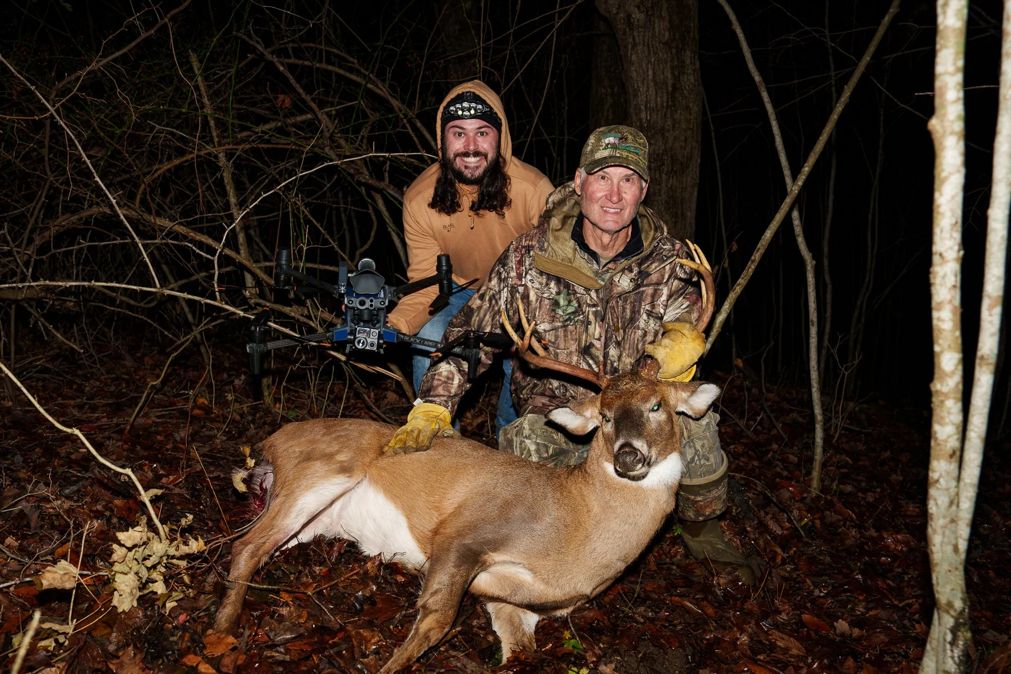
Our setup for deer recovery missions.
Our largest buck recovery to date! A close record breaker!


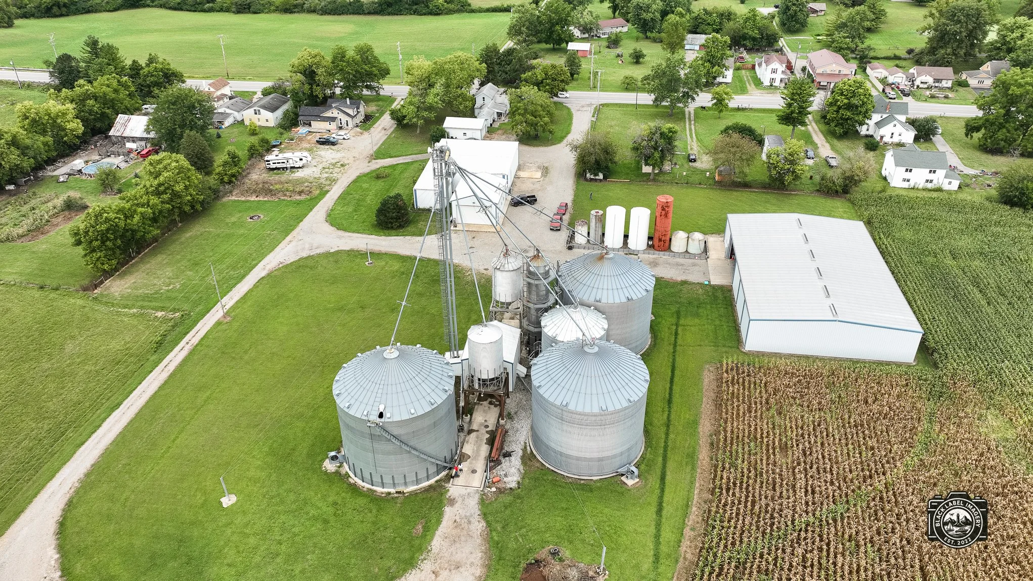
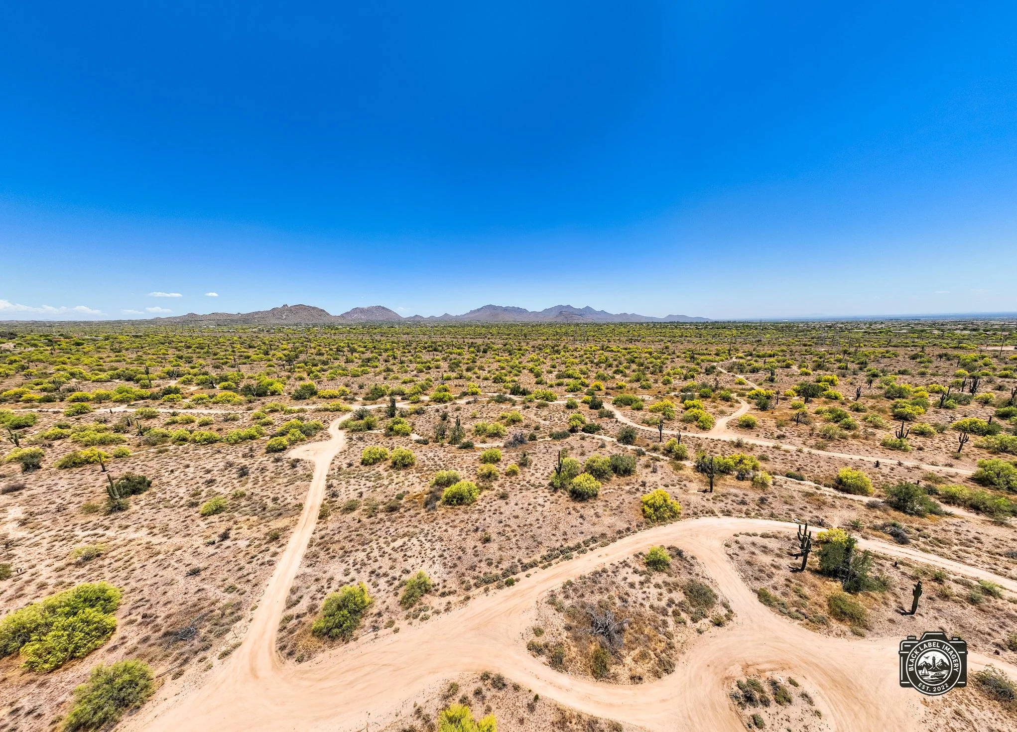
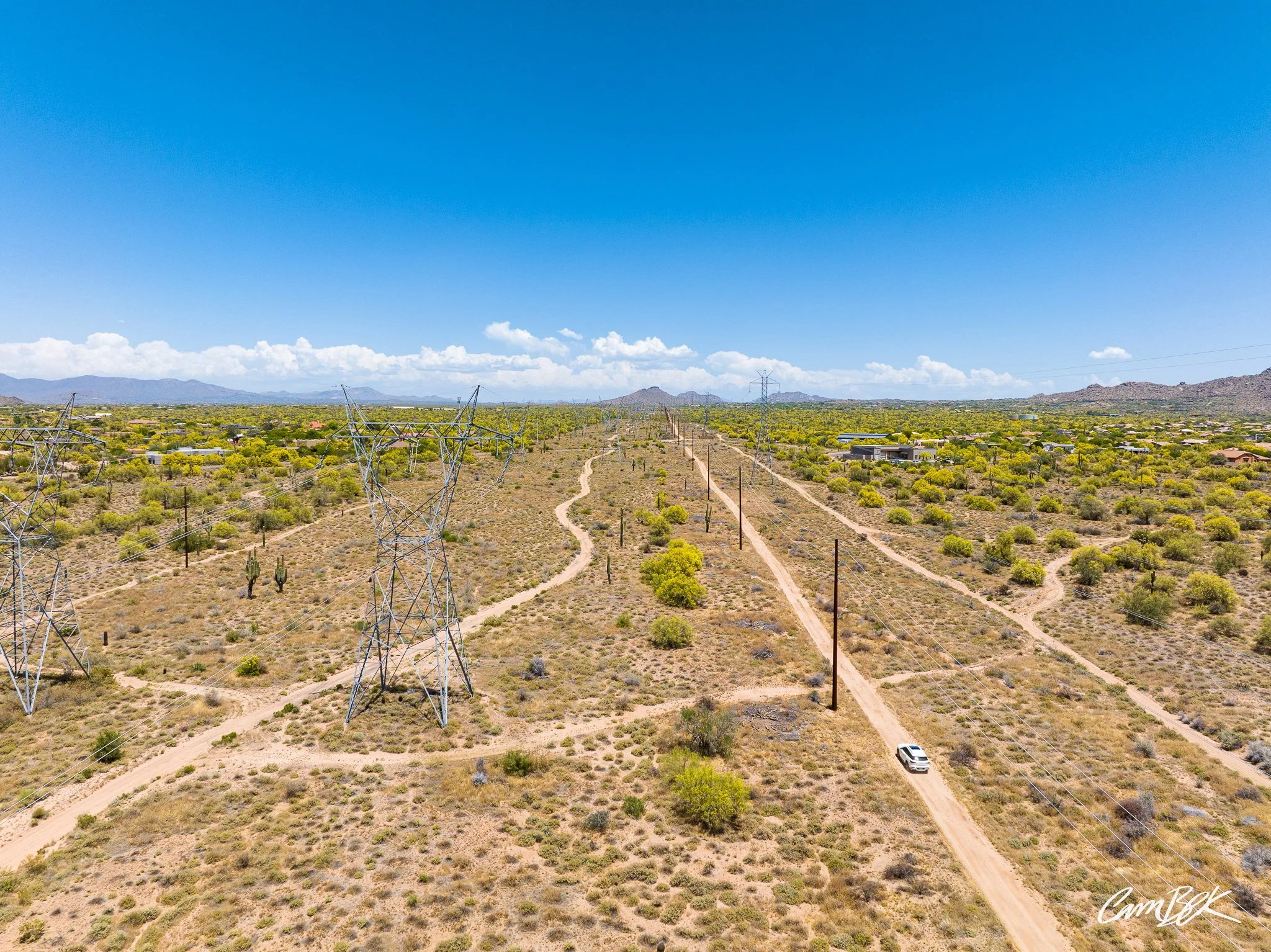
Aerial Imagery
Here at Black Label Imagery, we strive to provide the highest quality of aerial photography and videography on every project. We have had work featured in vacation guides and on billboards! We currently provide these services for almost any application from events, to construction progress. Every project is unique and we ask that you include as many details as possible when inquiring! Quotes can be more accurate based on the level of detail provided.